

Precision agriculture is a set of principles and technologies to optimize the management of agricultural land, to improve yields and to make the investments profitable. TRADITIONAL AGRICULTURE is based on the principle of the homogeneity of agricultural plots in the production cycle, principle which consists in applying cultural interventions (tillage, sowing, fertilization, crop protection) uniformly on each plot. However, the heterogeneity of the soils, translated by variations in pH, organic matter content, topography, etc. constitutes a source of significant variability for agricultural production. Over the past two decades, the context has changed: the GPS (Global Positioning System) localization system, on-farm computing, on-board electronics, ground sensors, soil analysis and remote sensing imagery make it possible to access, in particular by the yield maps, to a precise knowledge of this variability and to carry out interventions adapted. This new context was at the origin of the development of precision agriculture, a concept that we can express <the right intervention at the right place and at the right time>, and whose first applications appeared in the early 1980s, and which is becoming widespread in the agricultural world. Precision agriculture seeks to better take into account the variability of environments and conditions between different plots as well as at intra-plot scales. In comparison with traditional agriculture, it uses new information and digital technologies, such as imagery by remote sensing, measurement systems (sensors or in situ measurement), data sharing, monitoring systems GPS location and geographic information systems. These methods and tools are an important approach to allow agriculture to be more respectful of the environment while remaining productive, and makes it possible to better understand and analyze the physiological needs of crops and develop tools to help decision for the user. In this context, this professional Master offer, which is the first to focus on this field in our country, aims to train students to a double skill: solid knowledge and know-how in agronomy and in biology, and mastery of digital technologies. Human skills with this versatility are still extremely rare in our country, which hinders the promotion of precision agriculture on a large scale, especially for large crops, but also its acceptance by entrepreneurs and agricultural operators in the field. This training offer is therefore part of an overall national effort that aims to rationalize the use of agricultural land, rationalize the use of water and fertilizers, and adapt agricultural mechanization to the needs of agriculture in our country. This degree in Precision Agriculture is offered as part of the European project CBHE / CUPAGIS (https://www.cupagis.eu, New Curricula in Precision Agriculture Using GIS Technologies and Sensing Data) ”New Programs in Precision Agriculture Using Technologies GIS and Remote Sensing”, where a team of teachers is hired to master the teaching of the subjects of this Master.
Read More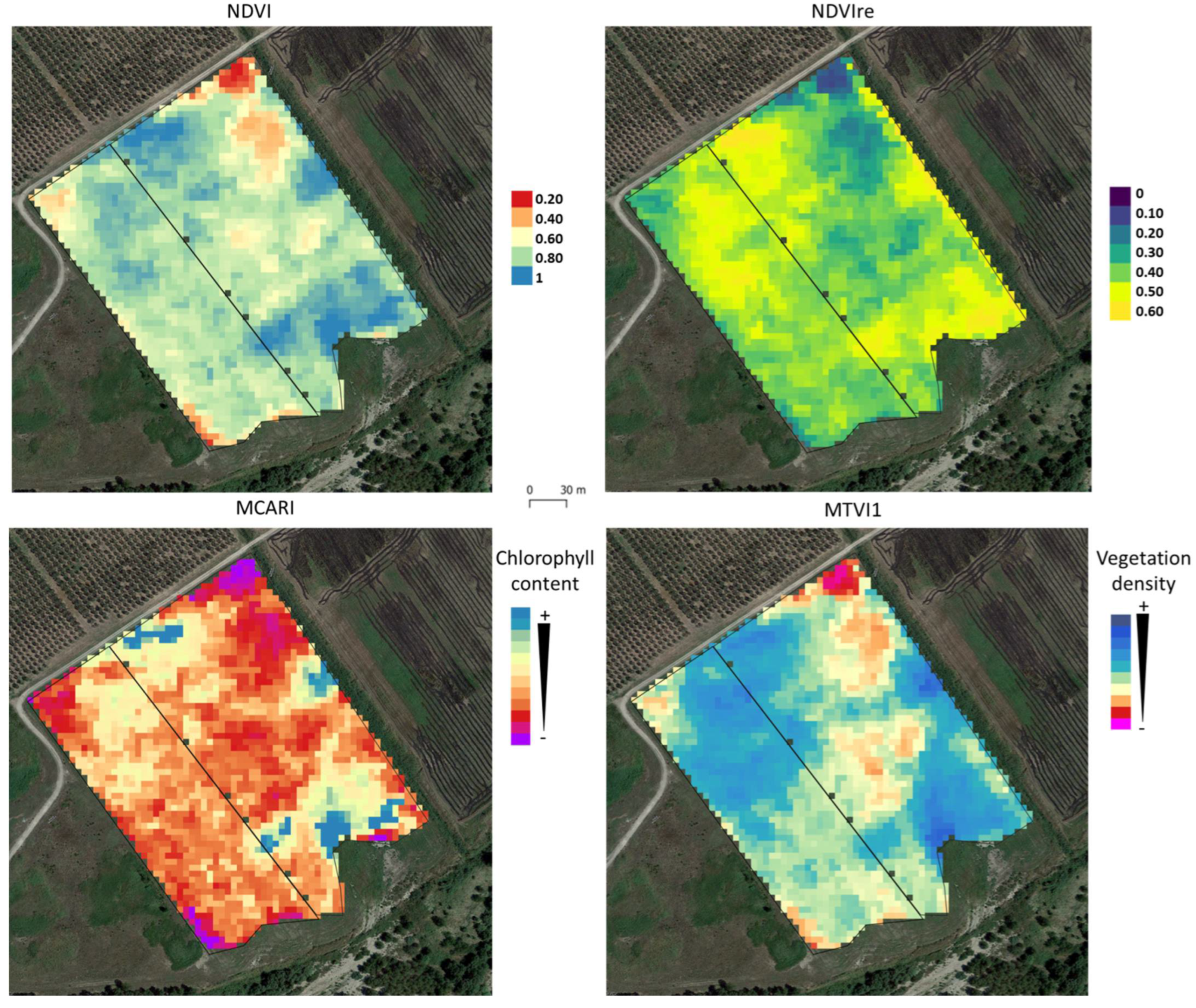
It is the measurement within an agricultural plot of the heterogeneity in soil, crops, pests, yields, altitude, soil water and soil nutrients…in the space and in time. Spatial variability: Variability at a given instant. Temporal variability: Variability over time. Decision support system: Design, Choose, Implement, Actions to optimize the management of the agricultural plot.
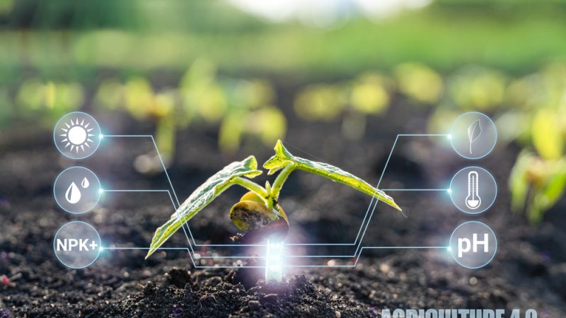
First, precision agriculture needs to collect data. The weather is an essential information in agriculture via connected weather stations. Temperature, humidity, rainfall, atmospheric pressure, wind speed and direction are available in classical stations (some stations add the duration of sunshine, UV radiation, ground temperature)... The farmer needs to know the state of his land. For example, humidity sensors, on different points of the agricultural plot, allow him to have remote visibility on the water needs of his crops. Precision agriculture also relies on images taken by satellites or drones to characterize the state of vegetation and soil. Getting information by drones or satellites allows the development of very precise agronomic maps.
Once the data has been collected, the precision farmer will use a computer environment to visualize his farm, to draw and modify the boundaries of his fields;
import data from sensors, in order to accurately map observations and operations. Agriculture will be able to make decisions to optimize the use of inputs using soil nutrient maps (pH, nitrogen, etc.);
analyze specific field performance data to find the best performing fields; simplify nutrient management plans with an easy-to-export format and ultimately visualize the agricultural plot and sort fields by characteristics such as crops or input application.




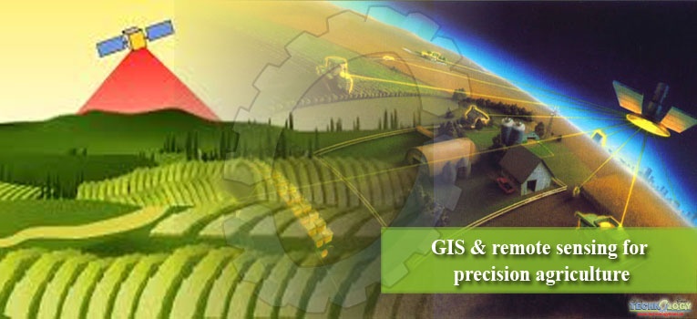
1- Semestre
|
Unité d’Enseignement |
VHS |
V.H hebdomadaire |
Coeff. |
Crédits |
Mode d'évaluation |
||||
|
14-16 sem. |
C |
TD |
TP |
Travail personnel |
Continu 40% |
Examen 60% |
|||
|
UE Fondamentale (P-E) |
|
|
|
|
|
||||
|
UEF 1 |
|
|
|
|
|
|
18 |
|
|
|
Remote sensing and application of earth and environment related to precision agriculture |
67h30' |
1h30' |
1h30' |
1h30' |
82h30' |
3 |
6 |
X |
X |
|
Les SIG en agriculture de précision I |
67h30' |
1h30' |
1h30' |
1h30' |
82h30' |
3 |
6 |
X |
X |
|
Soil properties and its measurement |
67h30' |
1h30' |
1h30' |
1h30' |
82h30' |
3 |
6 |
X |
X |
|
UE Méthodologie (B-A-B) |
|
|
|
|
|
||||
|
UEM |
|
|
|
|
|
|
9 |
|
|
|
B.P.A.C.T.E
|
45h |
1h30' |
1h30' |
- |
55h |
2 |
4 |
X |
X |
|
Biomathématiques et analyse des données |
60h |
1h30' |
1h00 |
1h30' |
65h |
3 |
5 |
X |
X |
|
UE Découverte |
|
|
|
|
|
||||
|
UED1 |
|
|
|
|
|
|
2 |
|
|
|
A.N.T.S.T |
45h |
1h30' |
1h30' |
- |
5h |
2 |
2 |
X |
X |
|
UE Transversale |
|
||||||||
|
UET1 |
|
|
|
|
|
|
1 |
|
|
|
Communication |
22h30' |
1h30' |
- |
- |
2h30' |
1 |
1 |
X |
X |
|
Total Semestre 01 |
375 |
10h30’ |
08h30’ |
06h |
375h |
17 |
30 |
|
|
* Basics of the Precision agriculture – characteristics, technologies, economic efficiency, optimal use of resources (B.P.A.C.T.E).
*Acceptation des nouvelles technologies «sur le terrain » (A.N.T.S.T).
2- Semestre02 :
![]()
|
Unité d’Enseignement |
VHS |
V.Hhebdomadaire |
Coeff. |
Crédits |
Mode d'évaluation |
|
||||||
|
14-16 sem. |
C |
TD |
TP |
Travail personnel |
Continu 40% |
Examen 60% |
|
|||||
|
UE fondamentale (P-E) |
|
|
||||||||||
|
UEF1 |
|
|
|
|
|
|
18 |
|
|
|
||
|
Course of sentinel 1 2 3 imagery for agriculture field monitoring |
67h30' |
1h30' |
1h30' |
1h30' |
82h30' |
3 |
6 |
X |
X |
|
||
|
Les SIG en agriculture de précision II |
67h30' |
1h30' |
1h30' |
1h30' |
82h30' |
3 |
6 |
X |
X |
|
||
|
Application of Precision Agriculture for crops growing |
67h30' |
1h30' |
1h30' |
1h30' |
82h30' |
3 |
6 |
X |
X |
|
||
|
UE méthodologie (B-A-B) |
|
|
||||||||||
|
UEM1 |
|
|
|
|
|
|
9 |
|
|
|
||
|
Sensors In Precision Agriculture |
60h |
1h30' |
1h00 |
1h30' |
65h |
3 |
5 |
X |
X |
|
||
|
Protection des Plantes Cultivées |
45h |
1h30' |
1h00' |
1h00' |
55h |
2 |
4 |
X |
X |
|
||
|
UED Découverte |
|
|
||||||||||
|
UED1 |
|
|
|
|
|
|
2 |
|
|
|||
|
Technologies Web |
45h |
1h30' |
1h30' |
- |
5h |
2 |
2 |
X |
X |
|||
|
UE transversale |
|
|
||||||||||
|
UET1(O/P) |
|
|
|
|
|
|
1 |
|
|
|||
|
Législation |
22h30' |
1h30' |
|
|
2h30' |
1 |
1 |
X |
X |
|||
|
Total Semestre 02 |
375h |
10h30’ |
08h00’ |
07h00' |
375 h |
17 |
30 |
|
|
|
||
3- Semestre03 :
![]()
|
Unité d’Enseignement |
VHS |
V.H hebdomadaire |
Coeff |
Crédits |
Mode d'évaluation |
||||||||
|
14-16 sem. |
C |
TD |
TP |
Travail Personnel |
Continu 40% |
Examen 60% |
|||||||
|
UE Fondamentale (P-E) |
|
||||||||||||
|
UEF1 |
|
|
|
|
|
|
18 |
|
|
||||
|
Cultures maraichères spéciales |
67h30' |
3h |
|
1h30' |
82h30' |
3 |
6 |
X |
X |
||||
|
Agrumiculture |
67h30' |
3h |
|
1h30' |
82h30' |
3 |
6 |
X |
X |
||||
|
Mechanization in precision farming |
67h30' |
3h |
1h30' |
|
82h30' |
3 |
6 |
X |
X |
||||
|
UE Méthodologie |
|
||||||||||||
|
UEM 1(O/P) |
|
|
|
|
|
|
9 |
|
|
||||
|
Anglais |
60h |
1h30' |
1h30' |
1h |
65h |
3 |
5 |
X |
X |
||||
|
Technique de recher.Biblio.et Rédact. |
45h |
1h30' |
1h30' |
- |
55h |
2 |
4 |
X |
X |
||||
|
UE Découverte |
|
||||||||||||
|
Start-up initiatives for future farmers |
45h |
1h30' |
- |
1h30' |
5h |
2 |
2 |
|
|
||||
|
UE Transversales |
|
||||||||||||
|
UET 1 (O/P) |
|
|
|
|
|
|
1 |
|
|
||||
|
Agricultural economy & entrepreneurship |
22h30' |
1h30' |
- |
- |
2h30' |
1 |
1 |
X |
X |
||||
|
Total Semestre 03 |
375h |
15h00’ |
4h30’ |
5h30’ |
375h |
17 |
30 |
|
|
||||
4- Semestre04 :
Domaine : S.N.V.
Filière : Sciences Agronomiques
Spécialité : Agriculture de précision
Un stage est réalisé au sein d’une structure de recherche ou en entreprise sanctionné par un mémoire et une soutenance sur un thème de recherche proposé, encadré (ou Co-encadré) par un ou deux enseignants-chercheurs
|
|
VHS |
Coeff |
Crédits |
|
Travail Personnel |
600h00' |
15 |
25 |
|
Stage en entreprise |
150h00' |
2 |
05 |
|
Séminaires |
- |
- |
- |
|
Autre (préciser) |
- |
- |
- |
|
Total Semestre 04 |
750 h |
17 |
30 |
5 - Récapitulatif global de la formation :
|
VH |
UEF |
UEM |
UED |
|
UET |
Total |
|
Cours |
270h00' |
135h00' |
67h30' |
|
67h30' |
540h00' |
|
TD |
157h30' |
120h00' |
45h00' |
|
- |
322h30' |
|
TP |
180h00' |
60h00' |
22h30' |
|
- |
262h30' |
|
Travail personnel |
742h30' |
360h00' |
15h00' |
|
7h30' |
1.125h00' |
|
Autres (Stage – Mémoire) |
600h00' |
150 h00' |
- |
|
- |
750h00' |
|
Total : |
1950h |
825 |
150h |
|
75h |
3000h |
|
Total Crédits : |
74 |
37 |
6 |
|
3 |
120 |
|
% en crédits pour chaque UE : |
61,67% |
30,83% |
5% |
|
2,50% |
100% |
CUPAGIS 2019 Djillali Liabes University. Algeria